


Plains Under Siege: Severe Thunderstorm Warnings Threaten Millions
Plains Under Siege: Severe Thunderstorm Warnings Threaten Millions
The skies are brewing, and the threat is real. Across a vast swathe of the United States, particularly throughout the Plains region, a multi-day severe thunderstorm risk is unfolding. Residents should brace themselves as the Storm Prediction Center (SPC) and the National Weather Service (NWS) are actively monitoring the situation and issuing warnings and watches as needed. These powerful storms bring with them a cocktail of dangerous conditions, posing significant risks to life and property.
A Recipe for Disaster: Heat, Moisture, and the Plains
The ingredients for this severe weather outbreak are readily apparent. A strengthening heat dome, a meteorological phenomenon where high pressure traps warm air and acts as a lid on the atmosphere, is currently dominating the western part of the U.S. This, combined with increased moisture streaming north from the Gulf, has created a volatile atmospheric environment. This setup is a prime breeding ground for powerful thunderstorms.
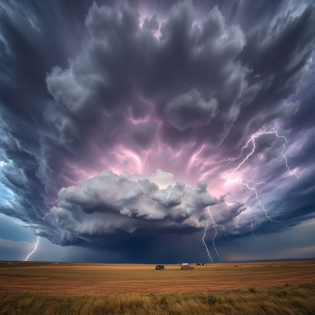
The combination of intense heat and abundant moisture creates a highly unstable atmosphere. This instability allows for the rapid development of towering cumulonimbus clouds – the signature of severe thunderstorms. These storms can quickly evolve into dangerous weather events.
The Hazards: What to Expect
The potential hazards associated with these thunderstorms are numerous and potentially devastating. Forecasters are particularly concerned about:
- Damaging Winds: Expect wind speeds reaching up to 70 mph, with isolated gusts potentially exceeding 80 mph. These powerful winds can down trees, damage buildings, and pose a significant risk to anyone outdoors.
- Large Hail: Hail, ranging in size from small pellets to potentially grapefruit-sized chunks, can cause significant damage to vehicles, homes, and crops. It also presents a serious threat of injury.
- Flash Flooding: Heavy rainfall, often associated with these storms, can lead to flash flooding, particularly in low-lying areas and near rivers and streams. Flash floods can be incredibly dangerous, sweeping away vehicles and posing a deadly threat.
Understanding the Warnings and Watches
Navigating the complexities of severe weather can be daunting, but understanding the terminology is crucial. The SPC utilizes a risk scale to communicate the severity of potential threats. The NWS then translates these risks into specific warnings and watches.
Severe Thunderstorm Watches are issued when conditions are favorable for severe thunderstorms to develop in a specific area. This means that people in the watch area should be prepared for the possibility of severe weather and stay informed about the latest forecasts.
Severe Thunderstorm Warnings are issued when severe weather is imminent or occurring and poses an immediate danger to life and property. This signifies that dangerous conditions, such as damaging winds, hail, or flash flooding, are happening, and immediate action is required. The NWS often works in tandem with trained spotters and law enforcement officials to gather real-time data that is crucial for issuing these warnings.
Staying Safe: Your Role in Preparedness
During a severe thunderstorm, it’s essential to take proactive steps to ensure your safety. If you are under a Severe Thunderstorm Warning:
- Seek shelter immediately in a sturdy building.
- Stay away from windows and doors.
- Monitor local news and weather updates for the latest information.
- If driving, pull over to a safe location and wait out the storm.
Preparedness is key. Make sure you have a way to receive weather alerts, such as a NOAA weather radio or a smartphone app. Have a plan in place for where you will take shelter in the event of a storm. Know the difference between a Severe Thunderstorm Watch and a Severe Thunderstorm Warning. By taking these precautions, you can significantly reduce your risk during a severe weather event.
The ongoing severe thunderstorm risk across the Plains is a stark reminder of the power of nature and the importance of staying informed and prepared. Pay close attention to the latest forecasts and warnings from the NWS and the SPC, and take action to protect yourself and your family.
The combined efforts of organizations like the NWS and the SPC, alongside the data supplied by trained spotters and law enforcement, are vital for providing accurate and timely information to the public. This information allows individuals to make informed decisions about their safety during these dangerous weather events.
As the situation evolves, be sure to stay updated on the latest developments.
For Further Reading:
To learn more about the severe thunderstorm outlook, consult the following sources:
https://www.accuweather.com/en/us/severe-weather
https://www.foxweather.com/weather-forecast/us-thunderstorm-warning-map-tracker
https://www.accuweather.com/en/severe-weather/multi-day-severe-risk-to-set-up-across-the-plains/1801699